 Summary:
|
|
Summary:
To provide attack, damage and strike assessment information, a system of improved nuclear detonation detection sensors has been developed. Formerly known as the Integrated Operational Nuclear Detection System (IONDS) and now called the Nuclear Detection System (NDS), these sensors will be deployed on board the Global Positioning System (GPS) constellation of navigation satellites scheduled to achieve full operational capability in the late 1980s. The Nuclear Detection System will provide precise location, yield, and height of burst information on any nuclear explosion worldwide. During peacetime, NDS will contribute to nuclear test ban monitoring; during the nuclear war it will also provide strike and damage assessment. If nuclear escalation is to be controlled, this system is essential to the United States as a survivable means of providing accurate, near real-time information on nuclear weapon results, both ours and the enemy's, allowing the National Command Authorities to select an appropriate response and enhancing retargeting and strategic force management. Terminals for NDS will come in tactical versions to provide the same nuclear detonation (NUDET) information to field commanders.
Further information from The U.S. Intelligence Community, 2ed (1989) by Jeffrey Richelson:
Detection of nuclear detonations is the secondary function of at least two satellite systems. Since the Defense Support Program (DSP) satellites' initial launch in 1971, their secondary function has been the detection of nuclear explosions in space or the atmosphere.The princpal mission of DSP satellites is to provide early warning of a Soviet missile attack. Hence, they also provide notification of Soviet, Chinese, and other nations' missile tests. The satellites are cylindrical and about 23 feet long and 9 feet in diameter, weighing up to 22,000 pounds. The means of detection is a twelve-foot-long Schmidt infrared telescope that is thirty-nine inches in diameter. The telescope has a two dimensional array of lead sulfide detectors at its focus to sense energy emitted by ballistic missile exhausts during the powered stages of their flights.
[...]
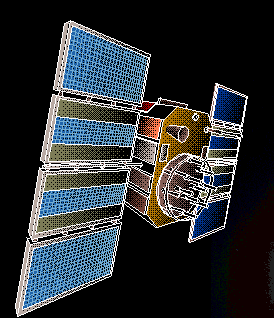
The prime means for providing trans- and post-attack nuclear detonation monitoring will be the Nuclear Detonation (NUDET) Detection System (NDS), carried on board the NAVSTAR Global Positioning System (GPS) satellites. The primary function of the GPS is to provide accurate locational data for targeting and navigational purposes; the NDS will represent a major secondary function.
[...]
Beginning with the launch of GPS-8 in 1983, the NDS has been carried (and will continue to be carried) on all GPS satellites.
[...]
The two NDC packages will include x-ray and optical sensors, Bhangmeters, EMP (electromagnetic pulse) sensors, and a data processing capability that will allow the detection of nuclear weapons detonations "anywhere in the world at any time and get its location down to less than a [100 meters]." Data will be reported on a real-time basis - either directly to ground stations located at Diego Garcia; Kwajalein Atoll; Ascension Island; Kaena Point, Hawaii; Andersen Air Base, Guam; Adak, Alaska - or first to airborne terminals or other GPS satellites for subsequent downlink transmissions. All principal U.S. command posts, including E-4B and EC-135 aircraft, will receive NDS sensor data directly.
Click here for the GPS outline taken from a presentation I gave at DefCon IV in 1996.
Boeing, the contractor for the follow-on GPS IIF space vehicles, has more information on GPS.
Trimble, an equipment manufacturer, has a good introduction to GPS.
| Index | PRN | NORAD | Block | NAVSTAR | USA |
|---|---|---|---|---|---|
| 1 | 2 | 28474 | IIR-13 | 56 | 180 |
| 2 | 12 | 29601 | IIRM-3 | 59 | 192 |
| 3 | 15 | 32260 | IIRM-4 | 60 | 196 |
| 4 | 16 | 27663 | IIR-8 | 51 | 166 |
| 5 | 17 | 28874 | IIRM-1 | 57 | 183 |
| 6 | 18 | 26690 | IIR-7 | 50 | 156 |
| 7 | 19 | 28190 | IIR-11 | 54 | 177 |
| 8 | 23 | 28361 | IIR-12 | 55 | 178 |
| 9 | 29 | 32384 | IIRM-5 | 61 | 199 |